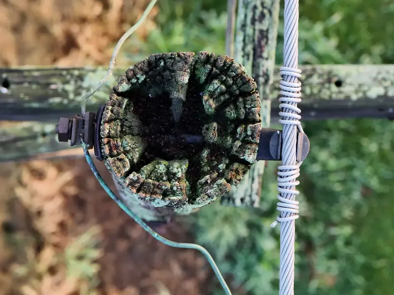
See the pole top before it takes the circuit down.
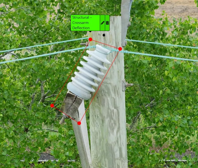
We fly your distribution lines with high-res visual and thermal cameras and hand you a prioritized defect list with GPS locations: pole-top rot, bad hardware, cracked insulators. The stuff you can't see from the ground.
On a recent inspection, 6 of the 7 pole tops we flew had problems.None of it was visible from the ground. That's the whole reason to put a camera up there.
Built around distribution work
Distribution inspections are what we do most. The other services come from the same crew and the same gear.
Distribution line & pole inspections
Pole by pole, span by span. Visual and thermal on every structure, reviewed by a person who knows what a bad crossarm looks like.
- High-res visual + thermal imaging of every pole top
- Finds rot, loose or failing hardware, cracked insulators and hot spots before they become outages
- Prioritized defect list with GPS coordinates, so crews go straight to the worst ones
- GIS-ready deliverables that drop into your system
- AI-assisted defect detection, checked by a human
Substation mapping & inspection
Visual and thermal coverage of the yard without putting anyone inside the fence longer than needed.
More →Contractor work QC
Spot checks on contractor work so you know the job got done the way it was written up.
More →Dam & hydro inspections NEW
Close-up looks at dam faces, spillways and hydro structures that are hard to reach.
More →Storm response
24/7 rapid deployment for damage assessment after storms. Same phone number, day or night.
More →Your inspection photos, on a map
Your inspection photos go into the GridView client portal. Log in and see your system the way the drone saw it.
How access works: tap “Request access,” and GridView approves it and sets up your company.
- GridView pilots upload the drone inspection photos
- GPS in each photo places it on an interactive satellite map
- Browse your inspection photos by territory and circuit
- Filter by severity and date
- See flagged issues like cracked insulators or vegetation contact
- Each utility sees only its own company's data
- Installs on your phone like an app
Field crew first, drone pilot second
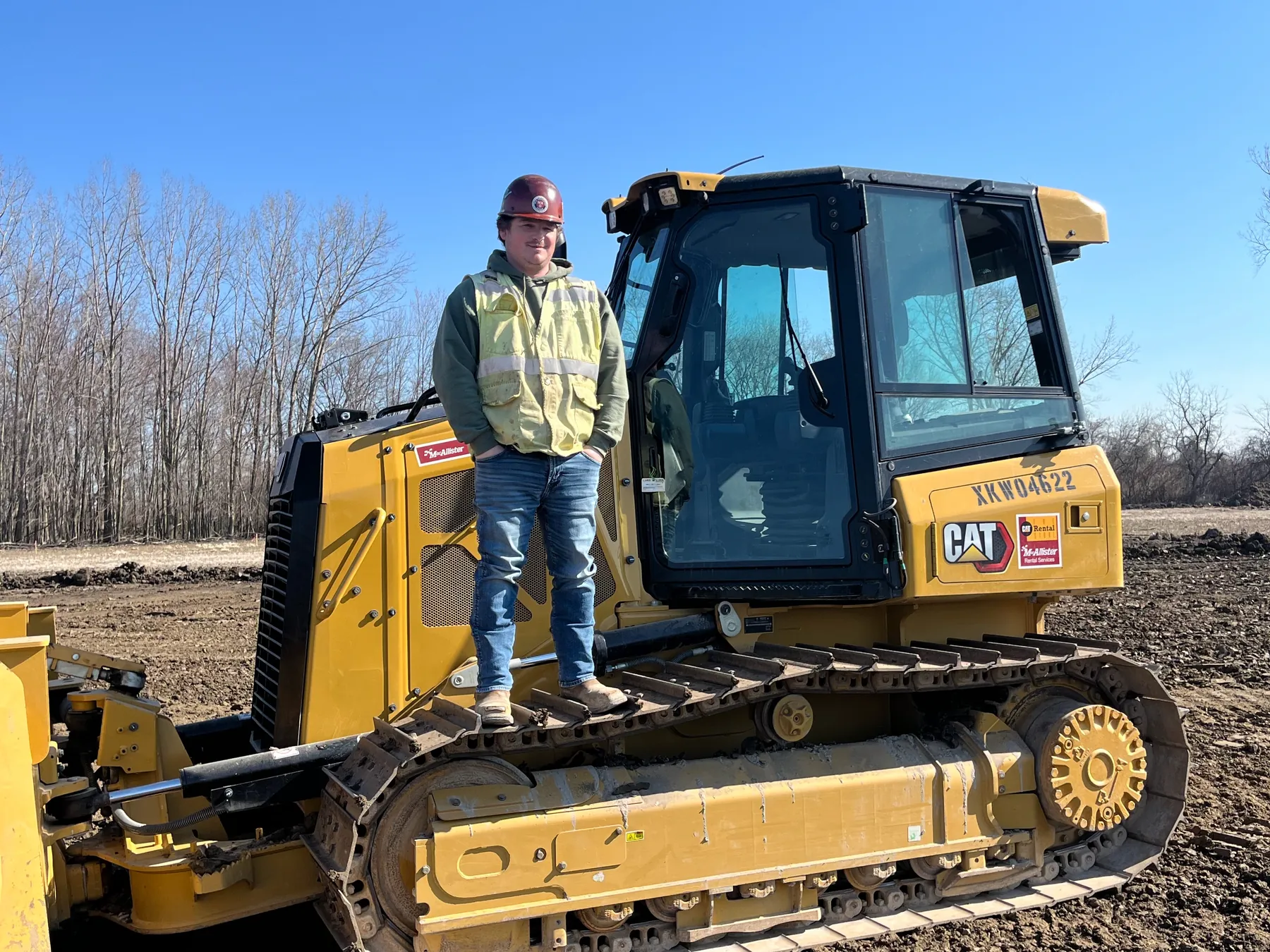
I'm Matt Brooks. Before I started GridView, I ran heavy equipment on utility jobsites. I know how a crew works, how a jobsite runs, and what's actually useful to a lineman versus what just looks nice in a slideshow.
So the reports are built for the people who have to go fix things: what's wrong, how bad, and exactly where it is.
- Safety-minded on the jobsite: OSHA 10/30 trained
- Plain reports your crews can act on
- Overflow capacity for investor-owned utilities when your own crews are booked
- FAA Part 107 certified
- OSHA 10 / OSHA 30
- SAM-registered government vendor
- AI-assisted defect detection
- GIS-ready deliverables
- Insurance: certificate available on request
Michigan, NW Ohio & NE Indiana
Based in Temperance, Michigan, right on the Ohio line. We cover:
- All of Michigan, Lower Peninsula and the Upper Peninsula
- Northwest Ohio
- Northeast Indiana
We work with electric co-ops, municipal utilities, line contractors, and investor-owned utilities that need overflow capacity.
Try us on one circuit
New utility partners get a discounted pilot circuit. Pick a stretch you're worried about, we fly it, and you get the full report. If it's not useful, you're not out much.